Posts

Showing posts with the label erosion

The ghosts of Covehithe
Image
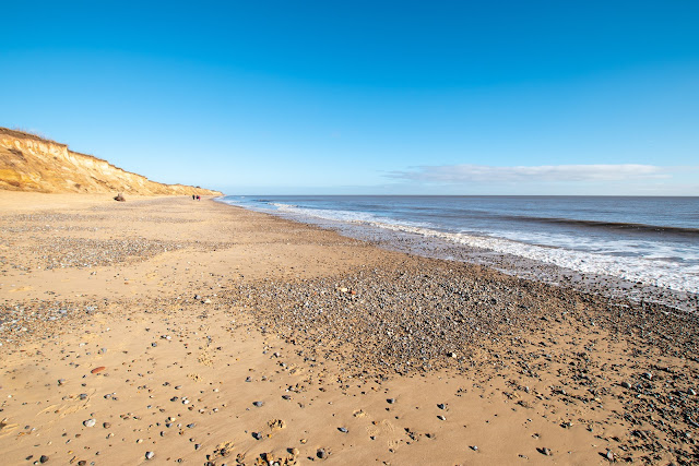
Covehithe is a hamlet which lies on the North Sea coast around 4 miles (6.4 km) north of Southwold and 7 miles (11 km) south of Lowestoft.  In the Middle Ages Covehithe prospered as a small town (no signs of that today!) It takes its modern name from the de Cove family who held land there at that time, and the fact that it had a hithe, or quay, for loading and unloading small vessels.There is also archaeological evidence of the linen industry having been carried out at Covehithe until the 18th century. So that`s where the wealth came from, like many ports on the coast, but now you could be forgiven for not knowing the village existed at all. A walk along the beach on a gorgeous day, gives you some idea of how deserted the area has become today.. It is just so peaceful on a day like this but, I reckon, very scary in stormy seas.  The coastline in the Covehithe area suffers from the highest rate of erosion in the UK, and the settlement has suffered significa...
What can be seen at Walton on the Naze?

Image
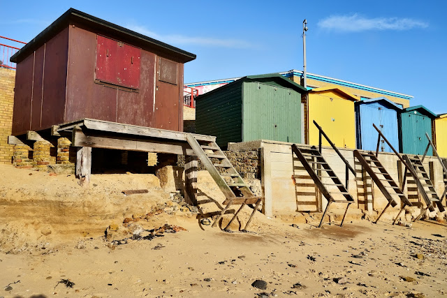
Walton is a traditional seaside town on the east coast, unique in that it is surrounded on three sides by the sea. Its three miles of gently shelving sandy beaches facing south-east stretch from Frinton to the Naze. To the north, the sea sweeps round the Naze into the backwaters, known as Hamford Water, and the Walton Channel stretches right down to Walton Mere, only 300 yards from the main beach. The Naze, as well as being a natural open space, is a Site of Special Scientific Interest (SSSI) famed for its fossils found in the Red Crag cliffs. As well as these glorious natural features, Walton is known for its pier – the second-longest in the country – its yacht club and marina, and its iconic tower at The Naze from where panoramic views can be enjoyed of the Walton backwaters, Harwich and Felixstowe and the Suffolk coast.  The coast of East Anglia is always subject to erosion and the day of our visit to Walton demonstrated the effects which a stormy period on the Nort...

What we saw in Walton

Image
One of our favourite seasides is Walton On The Naze, and it was to Walton, as is generally known, that we decided to spend the day. It's surprising what you can see when you are not in a hurry, and having a camera and photographs in mind. A good starting point is at the landmark point of the Naze Tower.  The Hanoverian tower, more commonly known as the Naze Tower, is situated at the start of the open area of the Naze. It was a navigational tower, constructed to assist ships on this otherwise fairly feature-less coast. Visitors can climb the 111-step spiral staircase to the top of the 86-foot (26 m) tower for a 360 degree view of the beach and countryside. The Naze Tower features a museum with exhibits about the tower, the ecology and geology of the Naze, and the coastal erosion problem. The tower also features a private art gallery on six floors with changing exhibits several times a year, and a tea room.  The present tower was built in 1720–21 by Trinity House...