A week in Vaynor Merthyr, The Brecons
Wales is a beautiful country and the area we were staying in had some walks with plenty of water and waterfalls. Vaynor Merthyr, is situated in the Brecons and so we were anticipating some glorious scenery and hoping for fine weather - we had both!
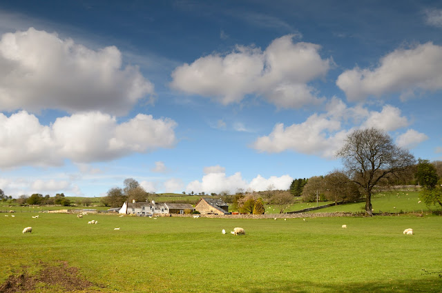
The scenery from the road as we turned into out driveway, and our cabin in its secluded grounds.
Although the water levels were not as high as we hoped, this part of the Four Waterfalls Walk was well worth it. We had a glorious day. Follow this link for a guide and description.
These are the stunning Sgwd-yr-Eira waterfalls on the Afon Mellte river. These fabulous waterfalls are located in a steep rocky ravine with the added bonus of being possible to walk a path going behind a curtain of water. We did - it was brilliant!
Near Pen y Fan - which is the highest peak in south Wales, situated in the Brecon Beacons National Park. It is 886 metres above sea-level but note, I said `near` not up!
The Brecon Beacons and the Brecon area have a long history of human habitation. Early settlements were mainly on the hill tops as the valleys would have been regularly flooded and covered in dense forest.
Evidence has been found of the manufacture of flint tools on the castle site, dating back 4000 to 5000 years. North West of the hotel is the remains of Pen-y-crug, an Iron Age hill fort. It may well have been occupied when the Romans arrived - Two miles to the west of Brecon lies Y-Gaer. a roman fort covering nearly 5 acres - The fort was built around 5O AD and may have been occupied as late as 300 AD. The first regiment in occupation probably came from North West Spain. Brecon was a Roman cross-roads and some roman roads remain visible on the Beacons even today.
In the fifth Century the local ruler is said to have sent his daughter to Ireland in search of a husband. Many of her retinue of guards died on the journey. She found her Irish Prince their son, Brychan, was sent to Wales to grow up at the Court of his grandfather. It is from the name 'Brychan' that the old country name of Brysheiniog and later 'Brecon' was derived. One of his daughters, called Tudful was killed by Barbarians. The welsh for martyr is merthyr, hence the settlement of Merthyr Tydfil 20 miles to the south got its name.
Brecon castle and town are Norman in origin. The castle came first and was the creation of Bernard de Neufmarche. He took his surname from the village of Neufmarche near Rouen, the capital of Normandy. He was of the second generation of conquerors who extended Norman influence into the Marches of Wales. By 1093 de Neufmarche and his knights had defeated the Welsh rulers of south Wales and began to build themselves the castles from which they intended to control their new lands.
While walking around Brecon we came across this gorgeous displays in a shop window
Vaynor Church near Merthyr Tydfil
This lady certainly had a long life - 106 according to this stone.
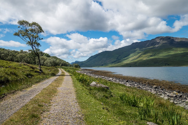
Some views toward the Brecons as we drove
Situated in the beautiful wilderness between the Brecon Beacons and the Black Mountain overlooked by the hills of Fan Fawr and Fan Gyhirych, is a truly massive sliver of rock. While it is over 3.5 metres tall and nearly 3 metres wide, it is only 75 centimetres thick and bears a striking resemblance to a giant Neolithic hand axe. Although it is aligned North-South, the sides of the rock become surprisingly warm to the touch on a sunny day.
This must have been an important pass between the hills, both to the local prehistoric population and to the Romans who came this way some 3000 years later - they built the road 'Sarn Helen' right by the stone and the current road still follows part of its course. According to legend, Maen Llia climbs the mountain to drink from the river Nedd every morning as the cock crows.
Another walk amongst the waterfalls led us to Sgwd Gwladus, The Lady Falls. The forested gorges between the villages of Pontneddfechan and Ystradfellte in the Fforest Fawr Geopark in the far southwest of Brecon Beacons National Park have so many cascades, they’re called Waterfall Country.
Sgwd Ddwli Uchaf - Gushing Falls is located on the Nedd Fechan and is one of three waterfalls along this section of the river. The falls has a drop of about 15 feet.
These images were, I believe, near the Horseshoe Falls. Not 100% sure!
Water trickling over rocks - just liked the scene and colours.
Soma amazing, and I suppose Victorian, monuments in the grounds of the Chapel near Melincourt
Aberdulais Falls on River Dulai
Aberdulais Tin Work
One of the major highlights at Aberdulais is the overshot water wheel, the largest electricity-generating water wheel in Europe. This huge wheel is not an historical relic; it actively generates green energy that is fed into the national power grid. The wheel dominates the site, though it is dwarfed by a solitary brick smokestack, which teeters high above the ruins of buildings used to process the tin. One of these is The Tin House, where iron plates were hand-dipped in pots of molten tin. Set in the floor you can still see the ash pits which were used to catch the residue from hot vats of tin and grease. Once dipped, the plates were cooled in oil, then polished, graded, and boxed for shipping around the world.
An extraordinary site combining over 400 years of industrial heritage with one of the most beautiful waterfalls in south Wales, Aberdulais has been used for copper smelting, iron working, milling textiles and grain, and working tin. These industries were drawn to Aberdulais for one major reason; the presence of readily available water power, provided by the falls, which tumble down a narrow gorge in the Dulais river. Over 160,000,000 litres of water can pass over the falls in a single day, providing a steady source of cheap water power.
The first industry to be established at Aberdulais was copper smelting, which sounds innocuous enough on the surface, but it was industry with a secretive purpose. The date was 1584, and Elizabeth I was in desperate need of money to prepare for a conflict with Spain; a conflict that would shortly bring the Spanish Armada sailing towards England. A German engineer named Ulrich Frosse designed a new method of smelting copper to turn into coinage. Elizabeth approved his plan, but naturally wanted the affair kept secret. Frosse decided to set up his copper smelting works at Aberdulais, far from prying eyes. It was a wise choice, for aside from water power, the site had ready access to timber and coal.
Pontsarn Viaduct Merthyr
Established by a Bill of 1858, the Brecon and Merthyr Tydfil Junction Railway was one of several serving the heavily industrialised areas of South Wales and Monmouthshire. Over the years, it absorbed a number of smaller companies and negotiated running powers on other lines. Despite being small in comparison with local competitors, it survived as a separate entity until railway grouping in 1923.
Its tendency for accidents gained it the unfortunate label of the "Breakneck and Murder Railway". These mishaps were largely driven by its severe gradients, one of which - a notorious 1:37 climb known as the Seven Mile Bank - presented the steepest continuous ascent on Britain's railway network.
To establish a route into Merthyr Tydfil, the company laid a line that curved around the town's west side to enter from the south. It extended for seven miles, descending from Pontsticill on gradients of 1:50 or steeper. Included were two viaducts, at Cefn Coed and Pontsarn, engineered by Alexander Sunderland and built by Savin & Ward.
Opened in 1867, Pontsarn Viaduct plots a straight course across the Afon Taf Fechan. Six years later, the local rector recorded 21 services a day using the structure, crossing at a height of 92 feet above the water. It comprises seven spans, with an overall reach of 152 yards.
Built entirely in limestone quarried from a nearby cutting, the structure was wide enough to accommodate two tracks but only one was laid. The parapets, which have been patch repaired in engineering brick, make no provision for refuges. A string course runs beneath them. Drain pipes emerge from the spandrels on both sides. Just below their impost bands, putlogs are apparent in the piers, used to hold the arches' timber centring during construction. Buttresses give support to the substantial abutments at their junction with the first arch.
The viaduct's period of operational service came to an end on 1st August 1966. It gained a Grade II* listing in August 1975. Both this and Cefn Coed Viaduct now form part of the Taff Trail cycle path.


Comments